
During the El Niño summit hosted at the University of Pretoria a few days ago Dr Christien Engelbrecht from the South African Weather Service made some interesting observations about precipitation events associated with cut-off low systems during very strong El Niño's in early spring in South Africa. Her graphs covered the period 1982-2025.
Here is the slide she shared:
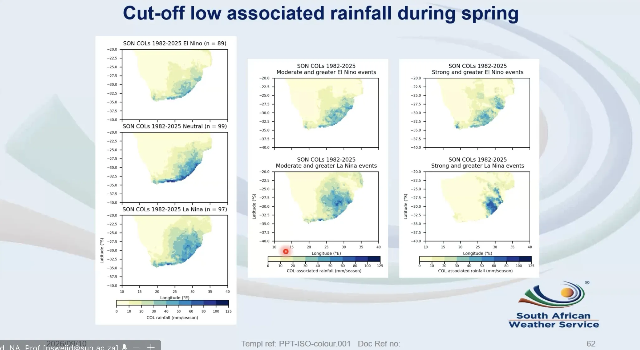
Her key message was that it is not uncommon to receive significant rainfall during spring even during strong or very strong El Niño events. When looking at the graphic above, just be aware that this is not rainfall per cut-off low event but rather rainfall for the Sep-Oct-Nov season. You see a clear footprint of increased precipitation across coastal KZN and even over Cape Town and surrounds.
This exact scenario is currently playing out despite the very strong El Niño that is already in place and strengthening.
Take a look at the latest warnings associate with the current cut-off low that is over South Africa at the moment:
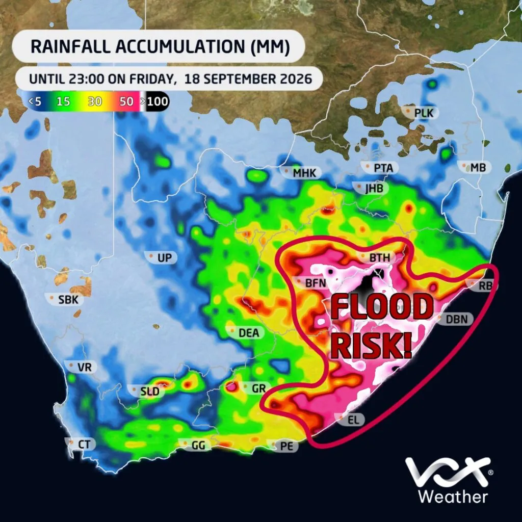
The above cut-off low powered rainfall distribution sits squarely in the regions that Dr. Engelbrecht highlighted in her presentation.
One thing that is important to understand from this, do not be fooled into thinking that significant rainfall events, like the one currently being experienced, to mean El Niño isn't affecting Southern Africa and that significant impacts are not possible later in the year as we move into summer and autumn 2027.
We will be sharing more about this in our September Climate Intelligence brief. Keep an eye out for that.