
As part of FutureClimate IQ’s El Niño impact early-warning system, we are now tracking three indicators that can provide early signs that hotter and drier conditions are taking root in the Garden Route.
Why these three?
Heat (maximum temperature) tells us how unusual recent daytime temperatures have been.
Atmospheric drying (VPD) tells us how strongly the air is drawing moisture from vegetation and other moist surfaces. The higher the VPD, the greater the drying pressure.
Evaporative demand (ET₀) estimates how much moisture the weather conditions could potentially remove through evaporation and plant water use.
We look at each over 7, 30 and 90 days. This helps distinguish a short-lived weather event (7-day) from a more persistent drying trend (30 to 90-days).
The percentile tells us how unusual the current conditions are compared with the same time of year during 1991–2020. For example, the 97th percentile means conditions were higher than about 97% of the comparable historical periods.
What is the current signal?
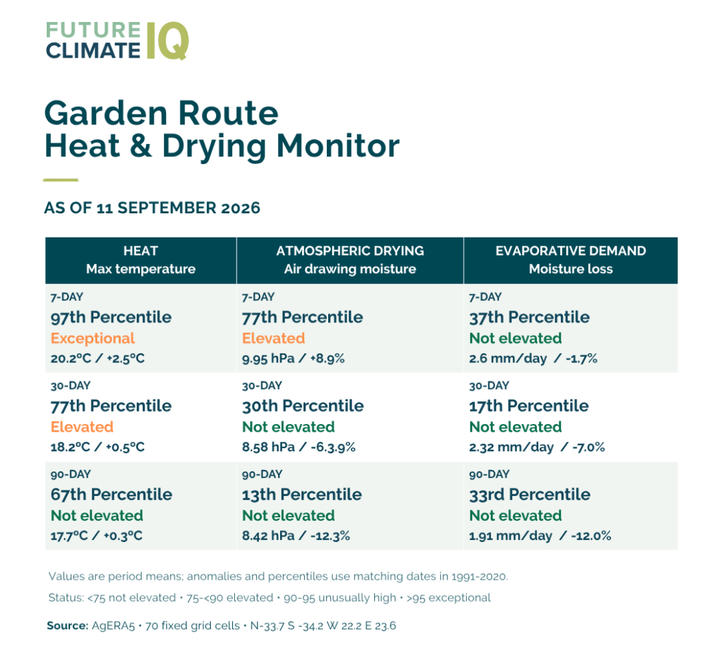
The seven days ending 11 September were exceptionally warm, with maximum temperatures reaching the 97th percentile. Atmospheric drying pressure was also elevated.
However, this has not developed into sustained drying. Over the longer 30- and 90-day periods, atmospheric drying and evaporative demand remain below the levels we would regard as elevated.
So, for now, the signal is:
Exceptional recent heat, but no evidence yet of sustained atmospheric drying.
This is why we will continue monitoring these indicators. If elevated heat and atmospheric drying begin persisting over 30 and eventually 90 days — particularly alongside declining rainfall and soil moisture — that would provide much stronger evidence that the region is moving towards increasing moisture stress.
You can see the whole warning system in context here.
Source: Copernicus AgERA5. Values are compared with matching dates during the 1991–2020 period.